Understanding Charleston's Bridges Before Choosing Where to Live
Understanding Charleston's Bridges Before Choosing Where to Live
In Charleston, a bridge is not just a way to cross water. It decides how long your commute takes, how easily you reach the airport, and how you leave town when a storm approaches. If you live on James Island, Mount Pleasant, Daniel Island, or one of the barrier islands, you depend on bridges every day. We are Leah Beaulieu and BJ Rodgers with Coast2Coast Properties, and we ask every relocating buyer the same thing: which bridge will you cross most often?
The question buyers are asking: How do Charleston's bridges affect where I should live? They affect commute reliability, evacuation, and convenience. Understanding them before you fall in love with a house is one of the smartest steps in a Charleston home search.
The short answer
- Most Charleston-area neighborhoods outside the peninsula depend on one or two bridges or causeways.
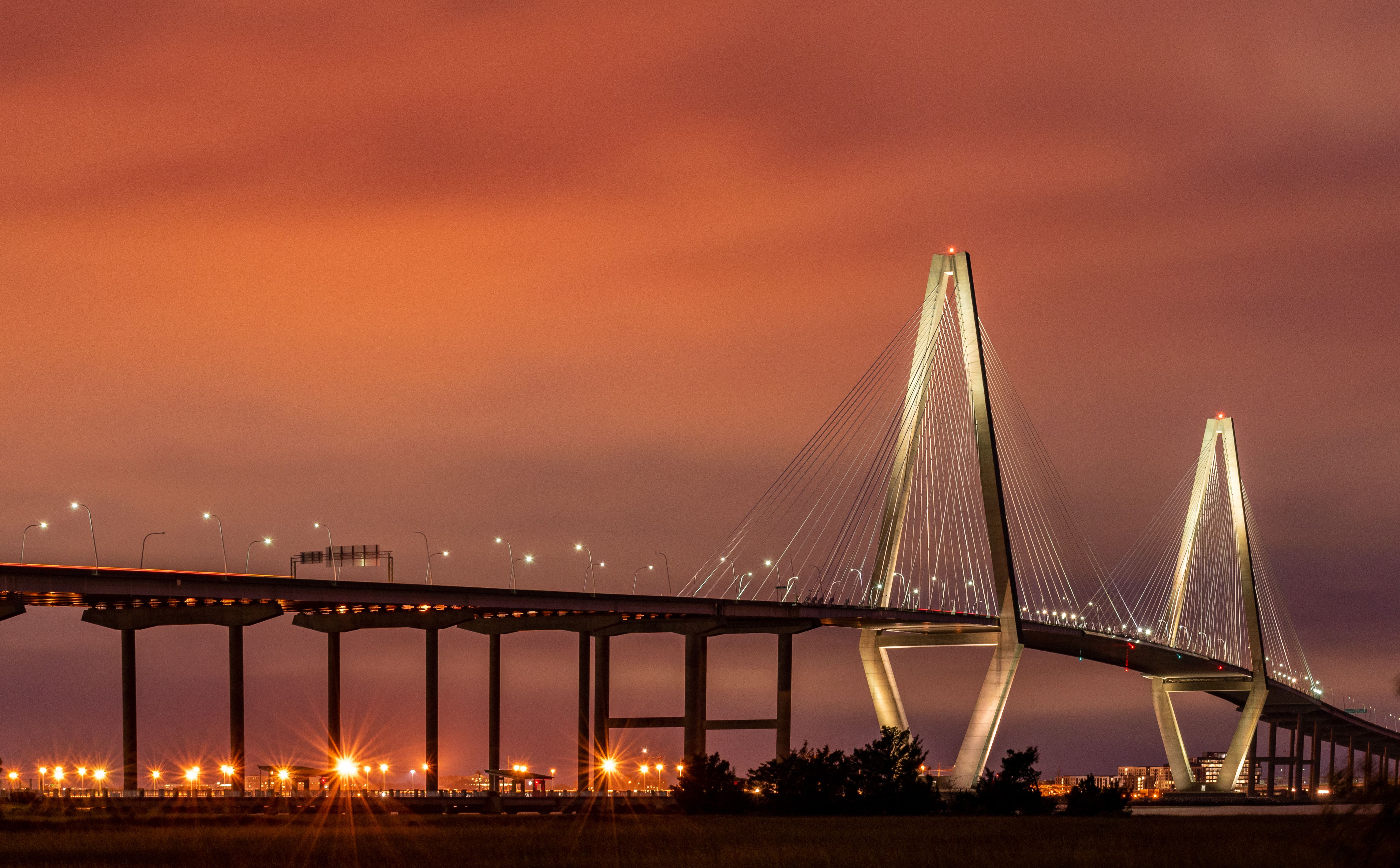
- The Arthur Ravenel Jr. Bridge links Mount Pleasant and downtown and carries heavy commuter traffic.
- The Isle of Palms Connector, completed in 1993, carries Isle of Palms traffic to US-17 in Mount Pleasant.
- James Island connects to downtown through the James Island Connector and Folly Road.
- Daniel Island relies on I-526 and Clements Ferry Road, with the Wando River crossing on I-526 key for reaching Mount Pleasant.
- Bridges close during high winds, and they are central to hurricane evacuation planning.
- A bridge crossing is not a problem by itself. It becomes one when you do not plan for it.
Which bridges matter most for Mount Pleasant buyers?
Mount Pleasant (29464 and 29466) is separated from downtown by the Cooper River, and the Arthur Ravenel Jr. Bridge is the most direct route. It is a modern eight-lane cable-stayed bridge and one of the region's most recognized landmarks, and it handles a great deal of commuter traffic. Local traffic guides note that rush-hour trips between Mount Pleasant and downtown can run 15 to 20 minutes longer than off-peak trips.
Mount Pleasant residents also use I-526 and the Wando River bridge to reach Daniel Island and North Charleston. Redfin data for August 2026 shows a Mount Pleasant median sale price of about $915,000 with homes taking around 64 days to sell. Many buyers there accept the bridge in exchange for schools, amenities, and lifestyle.
How do bridges affect the islands and beaches?
The barrier islands live and die by their bridges. Isle of Palms (29451) connects to Mount Pleasant through the Isle of Palms Connector, an 11,700-foot bridge and causeway that opened in 1993. Sullivan's Island (29482) connects through the Ben Sawyer Bridge, a swing bridge that opens for boat traffic. Folly Beach (29439) connects via the Folly Road route across James Island.
If you want a beach home, bridge dependence is part of the deal. Most owners say the tradeoff is worth it. The key is knowing that one access route can slow down on a holiday weekend, and planning errands around it.
What about James Island, West Ashley, and Johns Island?
James Island (29412) looks close to downtown on a map. In practice, you reach the peninsula through the James Island Connector or Folly Road, and both can back up at peak times. Redfin shows James Island at a median sale price near $605,000 in August 2026, with homes selling in about 57 days and at about 97.8 percent of list price.
West Ashley (29407 and 29414) reaches downtown across the Ashley River. Median sale price in August 2026 was about $515,000 according to Redfin, which makes it one of the more accessible areas close to the peninsula.
Johns Island (29455) depends on the Stono River crossing and a limited number of roads, which matters more as growth continues.
Why does Daniel Island work differently?
Daniel Island (29492) is a planned community with shops, restaurants, schools, offices, and parks. Many residents do not need to leave daily. When they do, they use I-526 or Clements Ferry Road. Redfin shows a median sale price of about $1.28 million in August 2026, down about 17 percent from the same period a year earlier, with homes taking around 84 days to sell. For buyers who like self-contained living, the island's design reduces bridge dependence for everyday life.
How do bridges affect hurricanes and high winds?
This matters more than many buyers expect. Charleston County has published procedures for closing bridges in high winds, and bridges can close before a storm makes landfall. If you live on an island or across a major river, your evacuation window is tied to those bridges. During evacuations, major routes like I-26 become heavily loaded.
Locals handle this by knowing their evacuation zone, leaving early, and never waiting for the last hour. It is a manageable part of coastal life when you plan ahead. Check current evacuation zones and bridge procedures with Charleston County before you buy.
The biggest mistake buyers make about Charleston bridges
The biggest mistake is ignoring the bridge until after closing. Buyers fall for a house, then discover the trip to their office, their child's activity, or the airport runs through a bridge that backs up every weekday at 8:00 AM. The fix is simple. Drive the route at the actual time you will make it, both ways, before you write an offer. Drive it on a Saturday in summer too if you are buying near the beach.
A realistic example
A family relocating from Chicago wants a home on Isle of Palms. The husband works at the Medical University downtown. On paper, the drive is about 25 minutes. They test it on a Tuesday at 7:30 AM and find it takes closer to 45 minutes once they cross the Isle of Palms Connector, US-17, and the Ravenel Bridge.
They still love the island. Instead of walking away, they adjust. He shifts his start time, they choose a home close to the connector, and they look at the evacuation plan for their zone. They close with no surprises. A second family with the same budget decides that commute is too much and buys on Daniel Island, where his office is close. Both families chose well because they chose with real information.
So what should buyers know about Charleston bridges?
- Identify which bridge you will cross most.
- Test the drive at your real times, both directions.
- Factor in beach weekends and tourist seasons.
- Know your hurricane evacuation zone and route.
- Weigh price and lifestyle against bridge dependence.
Frequently asked questions
What is the main bridge between Mount Pleasant and Charleston?
The Arthur Ravenel Jr. Bridge carries US-17 across the Cooper River between Mount Pleasant and downtown Charleston. It has eight lanes and a shared bike and pedestrian path.
Which Charleston neighborhoods depend most on bridges?
Mount Pleasant, James Island, Johns Island, Daniel Island, and the barrier islands (Isle of Palms, Sullivan's Island, Folly Beach) all rely on bridges or causeways for main access.
Do Charleston bridges close for storms?
Yes. Charleston County has procedures for closing bridges in sustained high winds, and bridges can close before a hurricane arrives. Plan to leave early when an evacuation is ordered.
How long is the Isle of Palms Connector?
Public sources list it at about 11,700 feet. It opened in 1993 and links US-17 in Mount Pleasant to Isle of Palms.
Is it a problem to live on an island with limited bridge access?
It is a tradeoff. Many residents love the lifestyle and plan around traffic. Buyers should understand access, flood exposure, and evacuation before purchasing.
Which area has the easiest commute to downtown Charleston?
The peninsula itself has the shortest trips. West Ashley and James Island are close but depend on river crossings. Mount Pleasant requires the Ravenel Bridge. Test your specific route.
Are homes near a bridge more or less valuable?
It depends. Easy access is a selling point, while direct bridge noise can reduce appeal for some buyers. Ask us about a specific property.
How do I know which bridge I will use most?
Map your weekly destinations, then run the route at your real times. Leah and BJ can help you compare neighborhoods against your routine.
Final answer
Charleston's bridges shape daily life more than most buyers expect. They affect your commute, your weekends, and your plan for storm season. The best buyers learn which bridge they will rely on, test it, and choose a neighborhood that fits their routine.
Bridges are part of what makes Charleston beautiful and part of what makes it complicated. Leah Beaulieu and BJ Rodgers at Coast2Coast Properties help buyers compare areas by commute, lifestyle, and price so you choose a home that works every day.
Market data: Redfin, August 2026 (three-month median sale prices). Bridge details from public sources; verify current bridge conditions and procedures before publishing.
About Leah Beaulieu & BJ Rodgers — Coast2Coast Properties
Leah Beaulieu and BJ Rodgers are Charleston, South Carolina real estate professionals with Coast2Coast Properties, helping buyers compare neighborhoods, understand local market differences, and find the right fit across the Charleston area. Whether you are buying your first home, relocating to the Lowcountry, or looking for investment opportunities, Leah and BJ bring local knowledge, straight talk, and a genuine commitment to helping clients make smart decisions.
Coast2Coast Properties
www.coast2coastprop.com
843-697-1409 / 803-201-4259