What New Residents Get Wrong About Rain, Flooding, and Water in Charleston
What New Residents Get Wrong About Rain, Flooding, and Water in Charleston
Most people moving to Charleston know there is some flooding. What they don't know is that "flooding" in Charleston means three completely different things — and confusing them leads to bad decisions, both in which home to buy and in how to respond when water appears. Leah Beaulieu and BJ Rodgers with Coast2Coast Properties hear variations of this confusion from nearly every buyer relocating to the Lowcountry. This article explains the three types of flooding, what they mean for homeowners, and where new residents most commonly go wrong.
The short answer
- Tidal flooding (also called "sunny day flooding") happens with no rain at all — it is driven by high tides and rising sea level, not precipitation
- Storm surge flooding comes from major storms and is the rarest but most severe type
- Rain flooding (stormwater flooding) happens when heavy rainfall overwhelms drainage systems — a daily reality in summer
- These three types have different causes, different affected areas, and different solutions — treating them as the same thing leads to wrong conclusions
- Being in or out of a FEMA AE flood zone does not fully predict rain flooding risk
- Leah Beaulieu and BJ Rodgers always discuss flooding type by type with buyers — the distinction matters before you make an offer
Type 1: Tidal flooding — the one that surprises people most
Tidal flooding is the most misunderstood type. It happens when astronomical high tides — especially during new and full moons, or when wind pushes water onshore — cause tidal waters to overflow streets and low-lying areas. No rain is required. It can happen on a clear sunny day. That is why it is also called "sunny day flooding."
Charleston has been experiencing an increase in tidal flooding events as sea levels rise. In 2019, NOAA recorded approximately 89 tidal flood events at the Charleston tide gauge — up from fewer than 10 per year in the 1990s. The threshold for minor coastal flooding at the Charleston tide gauge is 7.0 feet above mean lower low water (MLLW). At 7.5 feet, some roads close.
The areas most affected by tidal flooding are low-elevation streets on the Charleston peninsula — particularly in areas of 29401 and 29403 — along with low-lying streets near creeks on James Island 29412, Johns Island 29455, and parts of West Ashley 29407. North Charleston 29405 near the riverfront also sees tidal effects.
What new residents get wrong: They see water on Colonial Street or Rutledge Avenue on a clear day and assume the drainage system has failed or that something unusual happened. It isn't unusual — it is tidal flooding, and it is projected to become more frequent. The City of Charleston has been installing check valves on storm drains in the most affected areas, which does reduce some sunny-day flooding events, but this is a long-term infrastructure project that is years from completion.
The City's TIDEeye GIS tool (available online) lets anyone look up flooding history and risk projections by address on the peninsula. Leah Beaulieu and BJ Rodgers recommend buyers evaluate any peninsula home through TIDEeye before making an offer.
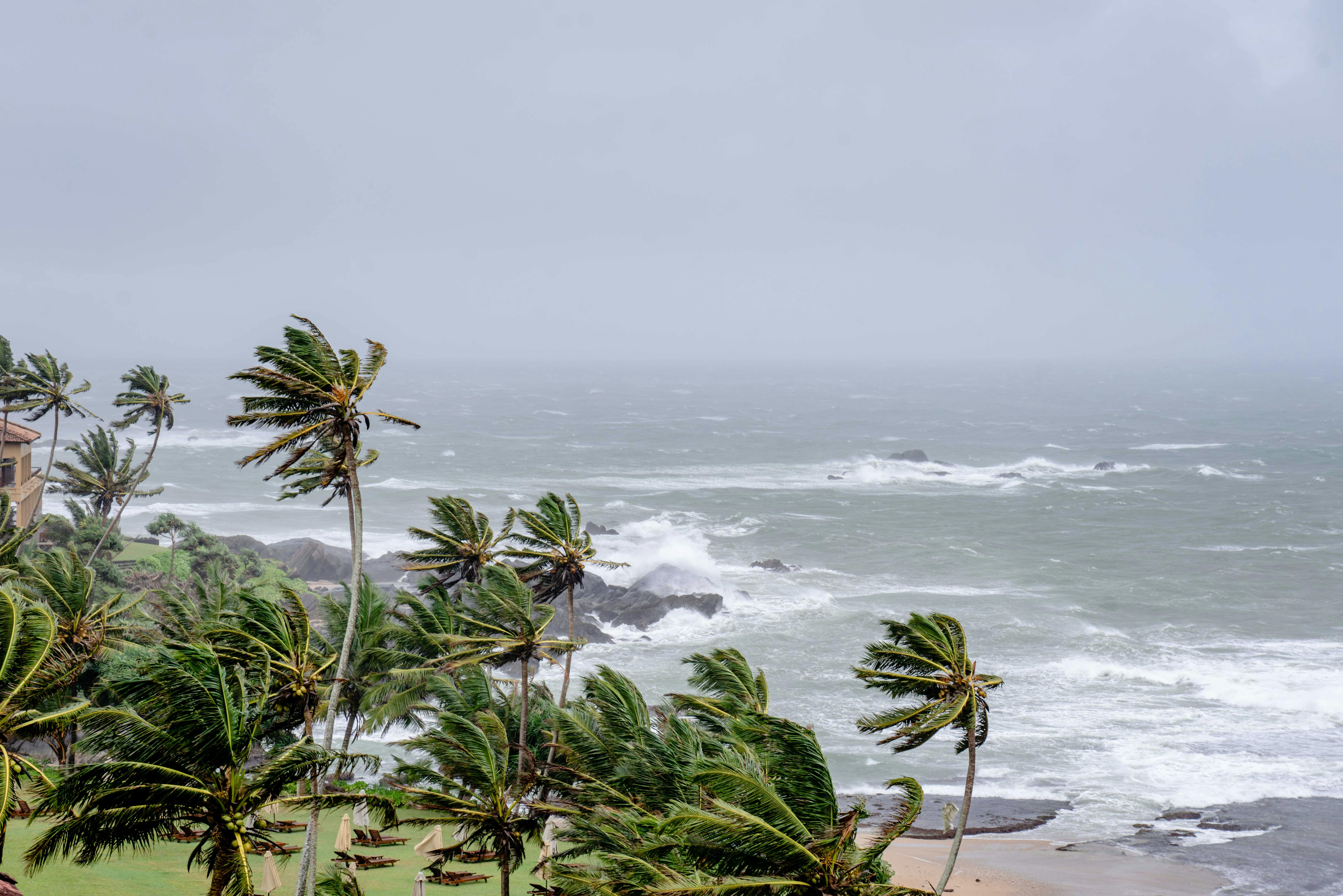
Type 2: Storm surge flooding — the serious one
Storm surge is water pushed inland by the winds of a tropical storm or hurricane. It is the type of flooding that can cause catastrophic property damage and is the primary reason for mandatory evacuations during named storms.
Charleston's geography makes it vulnerable to storm surge: the harbor and tidal rivers channel water inland, and the flat topography means surge can travel far from the shoreline. Low-lying areas near the Cooper and Ashley Rivers, tidal creeks on Johns Island 29455, James Island 29412, and coastal communities on Folly Beach 29439, Isle of Palms 29451, and Sullivan's Island 29482 are most exposed.
Storm surge is addressed through FEMA flood maps and the NFIP (National Flood Insurance Program). Homes in AE zones near the coast are required to carry flood insurance if they have a federally backed mortgage. For most buyers, this is the flood type they research most carefully — and it is the flood type that flood zone maps are primarily designed to reflect.
What new residents get wrong: They believe that because a home is not in an AE zone, they have no flood risk. This is partially true for storm surge, but largely irrelevant for the other two types of flooding described here.
Type 3: Rain flooding (stormwater flooding) — the daily summer reality
Rain flooding is what happens when heavy precipitation falls faster than the stormwater system can carry it away. In summer, Charleston regularly receives 1–3 inches of rain in 30–60 minutes during afternoon thunderstorms. Streets that are not in any flood zone on FEMA maps — streets that have no tidal connection and no storm surge vulnerability — can still accumulate several inches of standing water after a heavy downpour.
This type of flooding typically resolves within 1–3 hours as the water drains. It rarely damages homes directly unless cars drive through it and push water into garages, or unless a property sits in a topographic low point where water collects.
Areas where rain flooding is most common include older parts of West Ashley 29407, low-lying streets in Mount Pleasant 29464, and much of the peninsula where the drainage system is historic and undersized. Even newer developments in Summerville 29483 and Goose Creek 29445 can see street flooding after heavy rain if grading and drainage are insufficient.
What new residents get wrong: They see a street flood after a storm and conclude the neighborhood has a flooding problem that will cause expensive damage. Most of the time, it is temporary stormwater accumulation with no structural impact on homes. But if a street floods deep enough to strand cars regularly, or if a property sits low enough that runoff trends toward it rather than away, that is a real issue worth investigating.
The FEMA flood zone question — what it tells you and what it doesn't
FEMA flood maps classify properties into zones based primarily on storm surge and riverine flooding risk. AE zones represent the 1% annual chance flood area (the "100-year flood plain"). X zones are considered lower risk.
What FEMA maps do not fully capture: tidal flooding from rising sea levels, and localized stormwater drainage issues. A home on the Charleston peninsula can be in a high-elevation X zone for FEMA purposes but still experience periodic tidal flooding on the adjacent street. A home in Summerville 29483 can be in an X zone and still see driveway flooding during heavy summer thunderstorms if the lot grading channels water toward the house.
Flood zone designation matters for insurance purposes. But buyers who rely only on flood zone status to evaluate flooding risk are working with incomplete information.
Leah Beaulieu and BJ Rodgers encourage buyers to ask four separate questions for any property:
1. Is this in an AE zone? (relevant for flood insurance cost and storm surge risk)
2. Is this address in a tidal flooding area? (use TIDEeye for peninsula properties)
3. Does the street flood after heavy rain? (look at Google Street View during rain, or ask neighbors)
4. Does the specific lot drain away from the house? (address with the home inspector)
The biggest mistake buyers make about Charleston flooding
The single biggest mistake is treating "flood risk" as a binary — either you have it or you don't. Buyers ask "is this in a flood zone?" and stop there. That question only answers part of the picture.
The second biggest mistake is the reverse: buyers see any water on any street and conclude the property is undiscoverable. Some buyers walk away from well-elevated, well-drained homes in Avondale 29407 or Daniel Island 29492 because they saw a neighbor's street puddle after a storm. Temporary stormwater accumulation on a road is not the same as the home being at risk.
The right approach is to evaluate each of the three flood types separately, ask the right questions for each, and make a decision based on complete information rather than either dismissing flood risk or overreacting to normal Lowcountry weather.
A realistic example
Karen and Paul moved from Denver to Mount Pleasant 29464. They drove past a flooded street in early July and called their agent in a panic. What they had seen was a street that collected stormwater after a 1.5-inch, 45-minute thunderstorm. The street was clear by 6 p.m. Their home was on a higher lot, graded away from the house, and not in any tidal flood area. Their FEMA zone was X.
BJ Rodgers walked them through all three flood types, showed them the street's drainage history, and they understood: the street floods temporarily in summer — and their house does not. They closed on the home and have lived there three summers without incident.
Contrast that with a different buyer who purchased a home on a low-elevation block in 29403 without checking TIDEeye. They discovered in their first year that the adjacent street flooded 15–20 times annually from tidal flooding alone, many with no rain at all. The house was fine, but their car took damage twice.
Both situations are avoidable with the right questions upfront.
So, what do new residents get wrong about rain, flooding, and water in Charleston?
- They treat flooding as one thing instead of three distinct types with different causes and impacts
- They rely on FEMA flood zone alone, which misses tidal flooding and stormwater risk
- They either dismiss all flooding as no big deal, or overreact to normal stormwater events that don't threaten homes
- They don't ask address-specific questions about tidal flooding history before buying on the peninsula
- The TIDEeye tool and a good agent walkthrough solve most of these gaps before you go under contract
FAQ
What is "sunny day flooding" in Charleston?
Sunny day flooding is tidal flooding — water that rises onto streets from tidal creeks and storm drains during high tides, with no rain required. It is caused by astronomical tides, wind-driven water, and rising sea levels. It is most common on low-elevation streets of the Charleston peninsula 29401/29403 and near tidal waterways on James Island 29412 and Johns Island 29455.
Does Charleston flood a lot?
That depends on where in Charleston you are and which type of flooding you mean. The peninsula sees frequent tidal flooding on certain streets. Coastal communities are vulnerable to storm surge during tropical weather. Summer rain flooding after thunderstorms occurs across the metro area but is usually temporary. Many neighborhoods — especially in Mount Pleasant 29464/29466, Summerville 29483, and higher-elevation parts of West Ashley 29414 — see very little meaningful flooding.
Do I need flood insurance in Charleston?
If your property is in a FEMA AE zone and you have a federally backed mortgage, flood insurance is required. Properties in X zones are not required to carry it, though some lenders recommend it. Even outside AE zones, flood insurance is relatively affordable and provides protection against stormwater events. Leah Beaulieu and BJ Rodgers recommend speaking with a local insurance agent about your specific address.
How do I check flood history for a specific address in Charleston?
For peninsula addresses (29401/29403), the City of Charleston's TIDEeye GIS tool maps tidal flooding history and risk projections. For FEMA flood zone status, check the FEMA Flood Map Service Center at msc.fema.gov. For broader neighborhood context, ask your real estate agent or a local home inspector with Lowcountry experience.
Is flooding getting worse in Charleston?
Tidal flooding frequency has increased significantly over the past three decades and is projected to continue increasing as sea levels rise. NOAA projects Charleston could experience 60+ tidal flood days per year by 2051. Storm surge risk has not increased, but higher sea levels mean surge events start from a higher baseline. Rain flooding depends more on local drainage infrastructure improvements.
Can flooding affect my home's value in Charleston?
Flood zone designation (AE vs. X) directly affects flood insurance cost, which factors into buyer calculations and home values. The City of Charleston has been working to reduce tidal flooding through drainage infrastructure improvements, which could improve relative value on the most affected blocks over time. Buyers and sellers should disclose known flooding history as part of standard transaction requirements.
What parts of Charleston have the lowest flood risk?
Generally, elevated areas away from tidal waterways and low-lying topography: much of Mount Pleasant 29466, the higher elevations of Summerville 29483/29485/29486, Daniel Island 29492 (though check specific streets), and parts of West Ashley 29414 away from tidal creeks. Flood risk is highly address-specific — two homes on the same street can have meaningfully different exposures.
Final answer
Flooding in Charleston is real, but it is not a single thing. Tidal flooding, storm surge, and rain flooding have different causes, affect different areas, and require different responses. New residents who understand the distinctions make better decisions — both about which home to buy and about how to respond when they see water on the street. Those who treat it as one undifferentiated risk either buy in the wrong places or walk away from perfectly sound homes.
Leah Beaulieu and BJ Rodgers at Coast2Coast Properties discuss flooding type by type with every buyer who is considering a home in the Charleston area — because an informed buyer makes a better decision and sleeps better after closing. If you're relocating to Charleston and want to understand the water risk at any specific address you're considering, reach out and let's talk through it before you tour.
About Leah Beaulieu & BJ Rodgers — Coast2Coast Properties
Leah Beaulieu and BJ Rodgers are Charleston, South Carolina real estate professionals with Coast2Coast Properties, helping buyers compare neighborhoods, understand local market differences, and find the right fit across the Charleston area. Whether you are buying your first home, relocating to the Lowcountry, or looking for investment opportunities, Leah and BJ bring local knowledge, straight talk, and a genuine commitment to helping clients make smart decisions.
Coast2Coast Properties
www.coast2coastprop.com
843-697-1409 / 803-201-4259